Overview
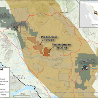
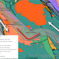
The Trident property is an exploration stage alkalic porphyry copper-gold-silver prospect with district-scale potential that is accessible by vehicle. The property is located approximately 50 km to the southeast of Northwest Copper Corp.’s Kwanika Deposit and 50 km to the northwest of Centrerra Gold’s Mt. Milligan Mine. The property covers 6,618 hectares and is accessible by vehicle using well established logging roads.
Copper mineralization on the property was first discovered by Colin Campbell in 1969, while following up on anomalous steam sediment samples. The following year Falconbridge optioned the property and over the next two years completed IP and magnetic surveys, geological mapping, soil sampling and diamond drilling. This work identified the A Zone.
Additional exploration programs were completed by Kookaburra Gold Corp. from 1988 through 1991, Solomon Resources Ltd., from 2006 through 2008. In 2013 PEMC optioned the property from Colin Campbell and completed a review of all historical data in addition to field work. The group of claims PEMC optioned from Colin Campbell at that time was referred to as the Col property. This ground was incorporated into a larger, ~24,000 hectare land position with PEMC's mineral claims to the west, which in now PEMC's Pinnacle (previously Later) property. The following year PEMC optioned the ~24,000 hectare Col-Later property to Oz Minerals. In 2014 Oz completed a significant IP survey and two diamond drill holes on the Col property. During 2015, Oz focused on PEMC's claims to the west and completed additional IP surveys in addition to a 6 hole diamond dril program.
Following the exploration programs by Oz Minerals in 2014 and 2015, Oz Minerals dropped the option, returning the property to PEMC. At this time PEMC was unable to meet the cash payments and exploration expenditures and as a result, reluctantly returned the Col property to the vendor.
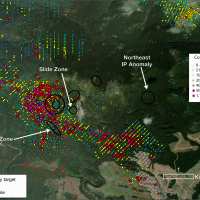
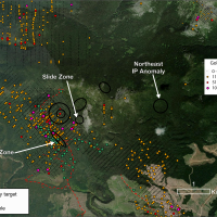
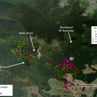
Over the next several years, as PEMC explored other properties, it became apparent that the Trident property was unique and warranted further exploration, following up on the nature and source of porphyry mineralization at the A Zone, the nature and source of mineralization at the Slide Zone and the significance of the IP chargeability signature in the northeast corner of the 2014 grid. All of the evidence suggested that the source of mineralization on the property was to the north of the A Zone, rather than to the east, south or west where historical drilling had been focused.
In 2022, Pacific Empire acquired a 100% interest in the property in exchange for granting the vendors a 2% net smelter return royalty ("NSR"). One-half (1%) of the 2% NSR may be purchased for $500,000 by Pacific Empire.
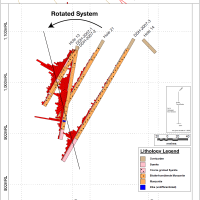
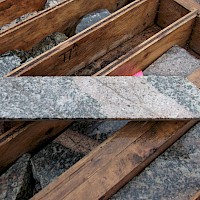
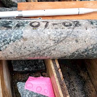
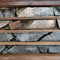
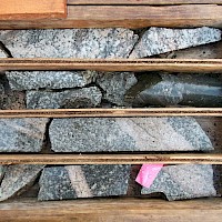
Prior to 2014, mineralization on the property was believed to be associated with fracture and/or shear zones that strike 120 degrees and dip 75 degrees to the northeast. Review of historical drill core by Pacific Empire has led to a much different interpretation with respect to the nature of mineralization on the property. The most important observation was the presence of horneblend-feldspar monzonite porphyry intrusions in drill core from the A Zone. These porphyry dikes are characterized by sheeted quartz sulphide veins and disseminated chalcopyrite and bornite immediately adjacent to and within the porphyry dikes. The highest grades in drilling are directly associated with intervals where such porphyry intrusions and dikes occur.
History
Exploration for copper porphyry deposits in the area began in the 1950's with the discovery of the Lorraine deposit. Exploration continued through the 1970's and 1980's when favorable gold and copper prices renewed interest in alkaline porphyry deposits, resulting in the discovery of the Mt. Milligan deposit 40 km east of the Trident property.
While following up on anomalous stream sediment geochemistry in 1969, Colin Campbell located the areas now known as the A Zone and Campbell's Trench.
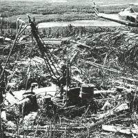
Falconbridge optioned the claims from Colin Campbell and conducted exploration programs in 1970 and 1971. This work consisted of soil geochemistry, geological mapping, a magnetometer survey, an Induced Polarization survey and diamond drilling. An access trail was also established that proceeded west along the north shore of Chuchi Lake, before proceeding north to the A Zone. Soil geochemistry outlined a significant copper anomaly over a broad area and a follow-up IP survey identified a number of chargeability anomalies. The chargeability anomaly designated A had a coincident copper in soil anomaly and mineralization on surface. A total of 13 packsack holes and 19 diamond drill holes were completed by Falconbridge. Results from this drilling outlined a historic (non 43-101compliant) resource estimate of 2-2.7 MT grading 0.6% copper at the A Zone.
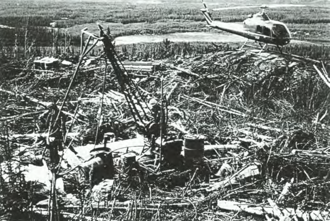
Following a property visit in October of 1987, an Option Agreement for the Col claims was signed with Kookaburra Gold Corporation in March of 1988.
The 1988 work program established a grid from the A Zone to the Campbell Trench Zone and collected 878 soil samples that were analyzed for Cu, Au, As, Pb, Zn, Ag & Fe.
In 1989 a work program completed trenching of nine trenches totaling 490 m, in addition 116 rock samples analyzed for Cu, Au and As. The previously established grid was expanded to the north, east and south with a further 78 soil samples collected and analyzed for Au and 6 element ICP. 22.4 line-km of pole-dipole IP survey was run on this grid. After the IP data was processed, and anomalies outlined,
217 soil samples were collected on select lines of the grid to test portions of the IP anomalies obtained. Select samples taken from chalcopyrite-bornite-chalcocite mineralized volcanics from the Slide Zone, assaying as high as 3.34% Cu, 0.106 opt Au and 1.6 opt Ag. Geological mapping was also completed.
Following a hiatus in 1990, exploration continued in 1991 with additional IP surveys, soil sampling and mapping. A diamond drill program consisting of 1524 m 11 holes was completed. The focus of this diamond drilling program were coincident copper soil geochemistry and IP chargeability anomalies approximately 1 km to the east of the A Zone. Results were described as disappointing and that they encountered a large shattered zone of intensely chloritized syenite and monzonite in all holes. The chlorite suggests that this is a propyllitic zone peripheral to a porphyry deposit, and the best copper mineralization occurs with potassic alteration. Potash metasomatism, along with copper mineralization, seems to increase west of the area drilled in 1991.
In 2006, Solomon Resources Ltd.optioned the Col property and subsequently added to the property by staking the Magnet West and Magnet East claims. The Col-Magnet property consisted of 48 mineral claims totaling 19,926 hectares. In the spring of 2007, Solomon contracted Fugro Airborne Systems Inc. to conduct an airborne DIGHEM survey over the property. The survey consisted of 1458 line-km. The data collected from the survey was processed and interpreted to produce magnetic and apparent resistivity maps. In the discussion submitted by Fugro it was noted that some porphyry deposits in British Columbia are characterized by resistivity highs and an associated slightly elevated magnetic susceptibility. Mt. Milligan is one such example. The report also recommended that any plug-like resistive units in the project area should be considered targets, particularly those exhibiting a weak to moderate magnetic correlation. The 2007 work program completed 2,564 m of diamond drilling (14 holes) on the central Col claims, extensive soil geochemical surveys, stream sediment surveys, trenching, geological mapping and stream sediment sampling. The focus of work was on the central Col claims, and expanding the known mineralization at the A Zone. An intersection of 0.6% copper and 0.14 to 0.32 g/t gold was reported over 25 meters in the A Zone. Prospecting in 2007 by Solomon at the Slide Zone located mineralization in the volcanics where select grab samples returned 17,700 ppm Cu, 948 ppb Au & 16.4 g/t Ag (sample 96568), 2113 ppm Cu (sample 96569), 5535 ppm Cu 429 ppb Au (sample 96571), and 3739 ppm Cu, 302 ppb Au (sample 96570).
A follow up program in 2008 consisted of eight diamond drill holes on 5 discrete targets totaling 1,043 m of NQ core. Highlights of this drilling include 0.43% copper and 0.51 g/t gold over 30 m (DDH-2008-1). Mineralization was reported to be associated with highly potassic altered dikes hosted in biotite-hornblende monzonite. Sulphides consisted of bornite, pyrite and chalcopyrite (Solomon Resources Ltd. Press Release, September 3, 2008).
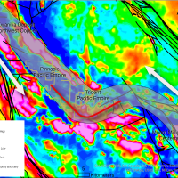
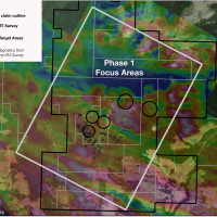
In 2013, Pacific Empire optioned the Col claims and completed a reconnaissance field program. In 2014 Pacific Empire entered into exploration agreement with Oz Minerals and during 2014 Oz completed 23.55 line-km IP survey and 847.5 m of diamond drilling in 2 holes. The IP survey covered all existing IP surveys on the property and outlined a number of moderate, discrete chargeability anomalies in the area where historical exploration had been focused. In the northeast portion of the grid, two relatively large, high-amplitude anomalies were identified. This area has seen very little exploration to date and represents a priority target area for Pacific Empire in 2024. The first drill hole was collared to the west of Campbells trench and intersected 12m of 0.3% Cu from 452m to 464m at the bottom of the hole.
To date, over 14,500 soil samples have been collected and digitized, 67 drill holes totaling 8,312 meters have been completed. Numerous geophysical surveys including Induced Polarization and Airborne Electromagnetic surveys have also been completed.

Geology and Mineralization
The property is located within the Quesnel Terrane, a volcanic arc terrane that formed along or near the western North American continental margin and accreted to the margin in the late Early Jurassic (186-181Ma). Quesnellia is found along most of the length of the Canadian Cordillera and in the Nation Lakes area is characterized by Late Triassic to Early Jurassic volcanic and sedimentary rocks of island arc affinity. The Quesnel arc had two phases of development, Late Triassic and Early Jurassic. The firrst, Late Triassic early arc development phase is dominated by augite phyric basalt and alkali basalt (shoshonitic) volcanism. Basal sediments of the Slate Creek succession (235-204 Ma) grade upwards into increasingly volcanic and volcaniclastic rocks of the Inzana, Willy George, Plughat Mountain and Witch Lake successions (230-204 Ma), collectively referred to as the Takla Group. A depositional hiatus marks a break in volcanic activity prior to the onset of renewed volcanic activity in the Early Jurassic.
The second phase of arc development began in the early Jurassic and is characteristic of a more mature arc, developed on thicker crust. These early Jurassic volcanic suites were compositionally more heterogeneous and dominated by plagioclase and plagioclase-augite phyric, sub-alkaline to shoshonitic lithologies. The Triassic arc successions are overlain paraconformably by the early Jurassic suites of the Chuchi Lake and Twin Creek successions.
The Hogem batholith differs from other Upper Triassic batholiths in the Quesnel terrane in two signifcant ways.
- It is unusually long lived (Late Triassic to Cretaceous) rather than confined to a shorter interval near the Triassic-Jurassic boundary such as the Guichon and Iron Mask Batholiths.
- The Guichon and Iron Mask Batholiths are calc-alkaline and alkaline respectively, whereas the Hogem Batholith is composed of four phases which alternate from alkaline to calc-alkaline, with each phase becoming progressively more felsic.
The economic importance of the Quesnel arc is demonstrated by its rich endowment of porphyry copper-gold mineral deposits.
The Trident project area is underlain by Early Jurassic shoshonitic volcanic rocks of the Chuchi Lake Succession and a variety of intrusive phases related to the Late Triassic to Early Jurassic Hogem Intrusive Suite, within the accreted Quesnel Terrane. Volcanic rocks are dominated by andesitic porphyry ows and pyroclastics. Intrusive rocks make up a wide variety of rock types, ranging from horblende pyroxenites to syenites. Intrusive rocks in the Trident area are dominated by monzonites which are cut by younger syenites. At the A Zone, discrete porphyry intrusions that are responsible for copper-gold mineralization appear to be cutting all intrusive phases and may represent a later intrusive episode.
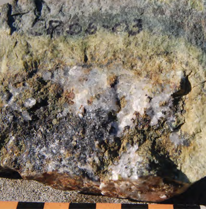
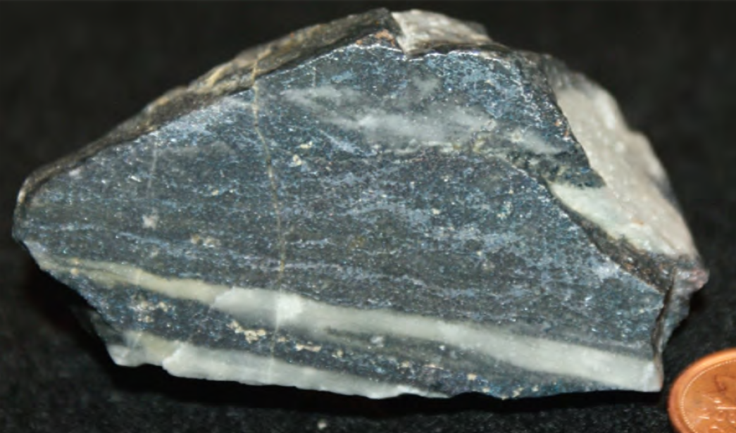
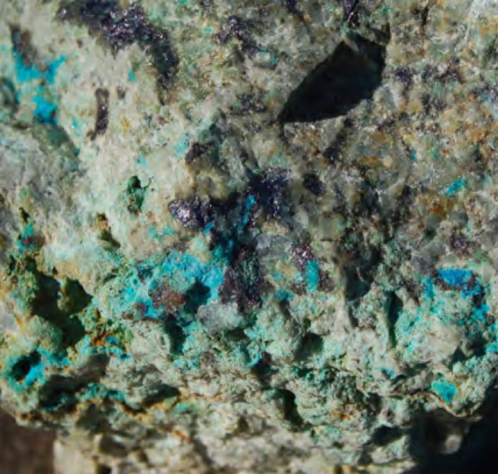
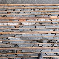
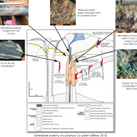
Mineralization in the Trident area encountered in historic drilling consists of quartz-chalcopyrite ± bornite veins, veinlets and disseminations associated with calc-potassic, potassic and propylitic alteration assemblages. Intercepts up to 102 m of 0.588% Cu & 0.244 g/t Au have been encountered, with many smaller but higher grade intercepts achieved as well. It is these smaller, yet higher-grade intercepts that appear to be directly related to the porphyry intrusions encountered in diamond drilling. Mineralization on the property is most significant in three areas, 1) the A Zone, 2) Campbell Trench and 3) Slide Zone.
The A Zone
At the A Zone, copper-gold mineralization occurs along a strike length of approximately 300 metres at an azimuth of 120o and where best developed it is approximately 30 meters wide over a length of approximately 175 metres. This zone was tested by a number of small diameter drill holes by Falconbridge in 1971 with the best intersections assaying 0.84% Cu over 45.7 meters and 0.70% Cu over 51.8 metres (DDH-1971-13 and DDH-1971-20, respectively). In 2007, Solomon Resources followed up with diamond drilling at the A Zone and demonstrated that mineralization extended at depth.
Until 2014, mineralization at the A Zone was believed to be associated with a shear zone, however while reviewing drill core from the A Zone, PEMC observed the presence of very well mineralized porphyry intrusions that are most likely responsible for the coper-gold mineralization due to their intimate relationship with quartz-sulphide veining and mineralization.
Campbell Trench Zone
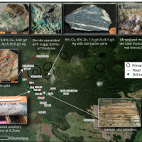
Located approximately 1 km to the northwest and 150 m higher in elevation, the Campbell Trench Zone may be representative of a higher level within the porphyry-epithermal spectrum. This area is characterized by the presence of large quartz veins associated with copper-gold mineralization. Visible gold was observed in outcrop at this location in 2007.
Visible gold 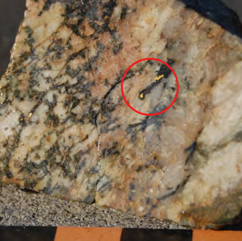
The Slide Zone
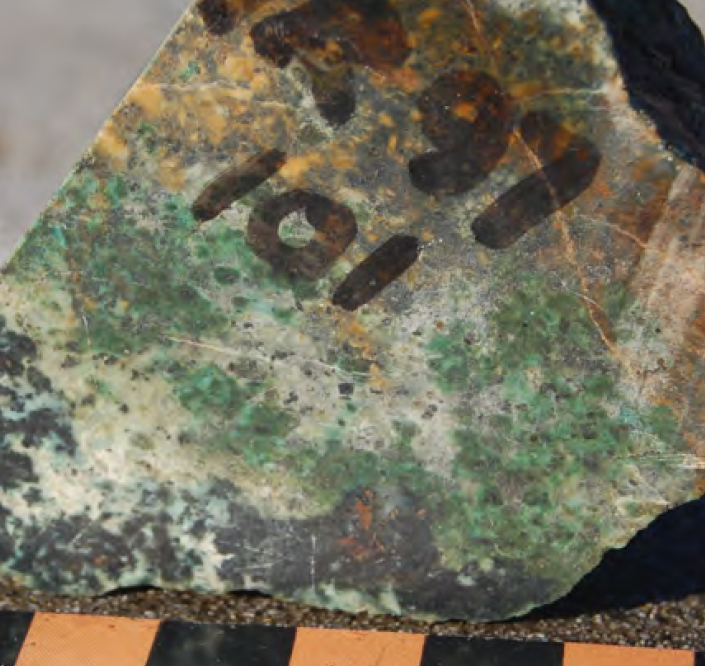
One of the more intriguing examples of mineralization on the property can be found at the Slide Zone. Located approximately 1 km to the northeast of the A Zone, the Slide Zone occurs within Chuchi Lake Succession volcanic rocks and is characterized by a wide variety of mineralizatoin styles.
Select grab samples from the area in 2007 returned the following values:
17,700 ppm Cu, 948 ppb Au, 16.4 ppm Ag; Sample 96568
5,535 ppm Cu, 429 ppb Au; Sample 96571;
3,739 ppm Cu, 302 ppb Au; Sample 96570
In this area, the occurrence of mineralized monzonite clasts within volcanic rocks suggests the source may be a hydrothermal breccia in the immediate area. This is a priority target for follow up in 2024.
