Location:
North-Central British Columbia
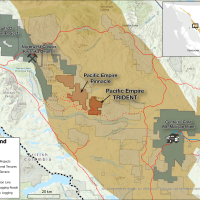
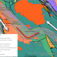
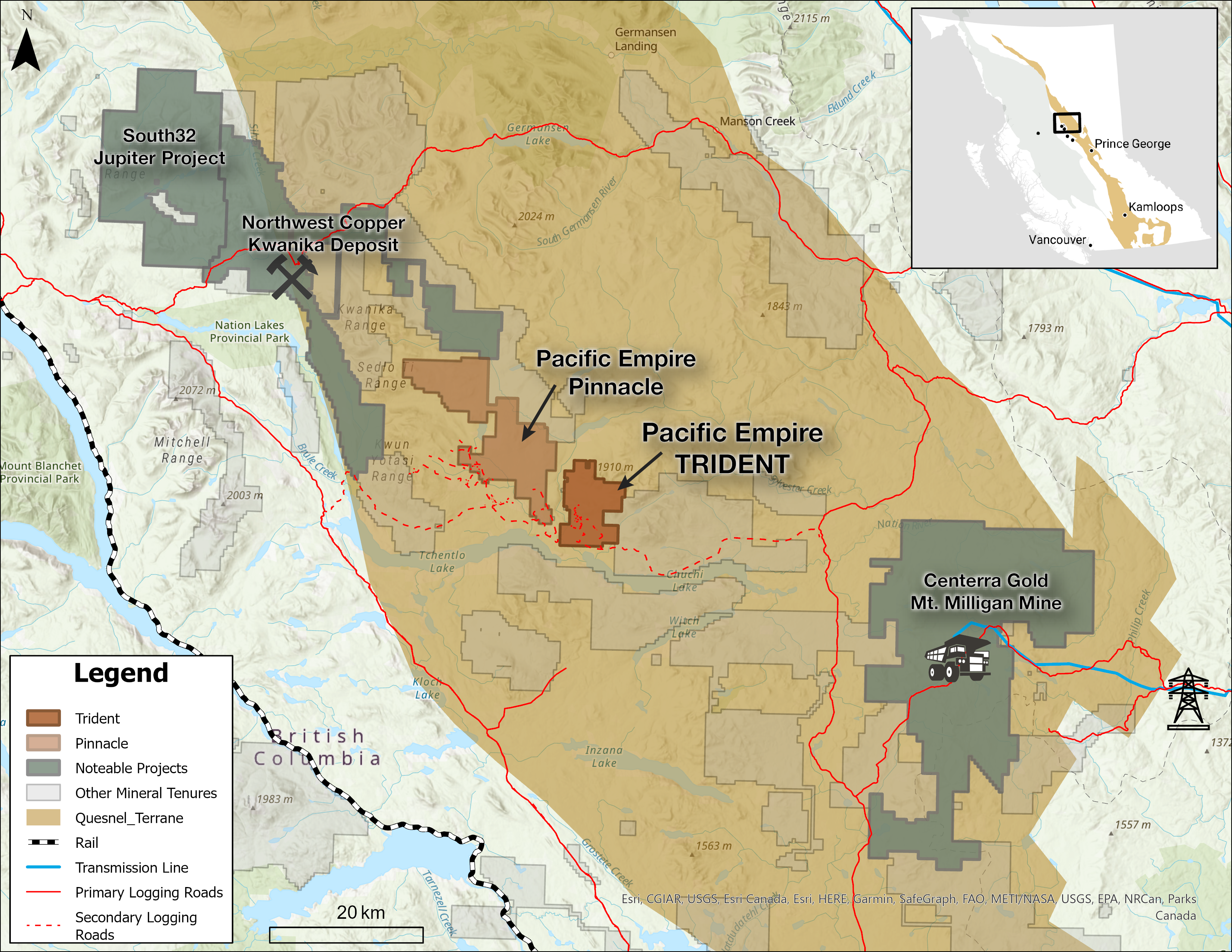
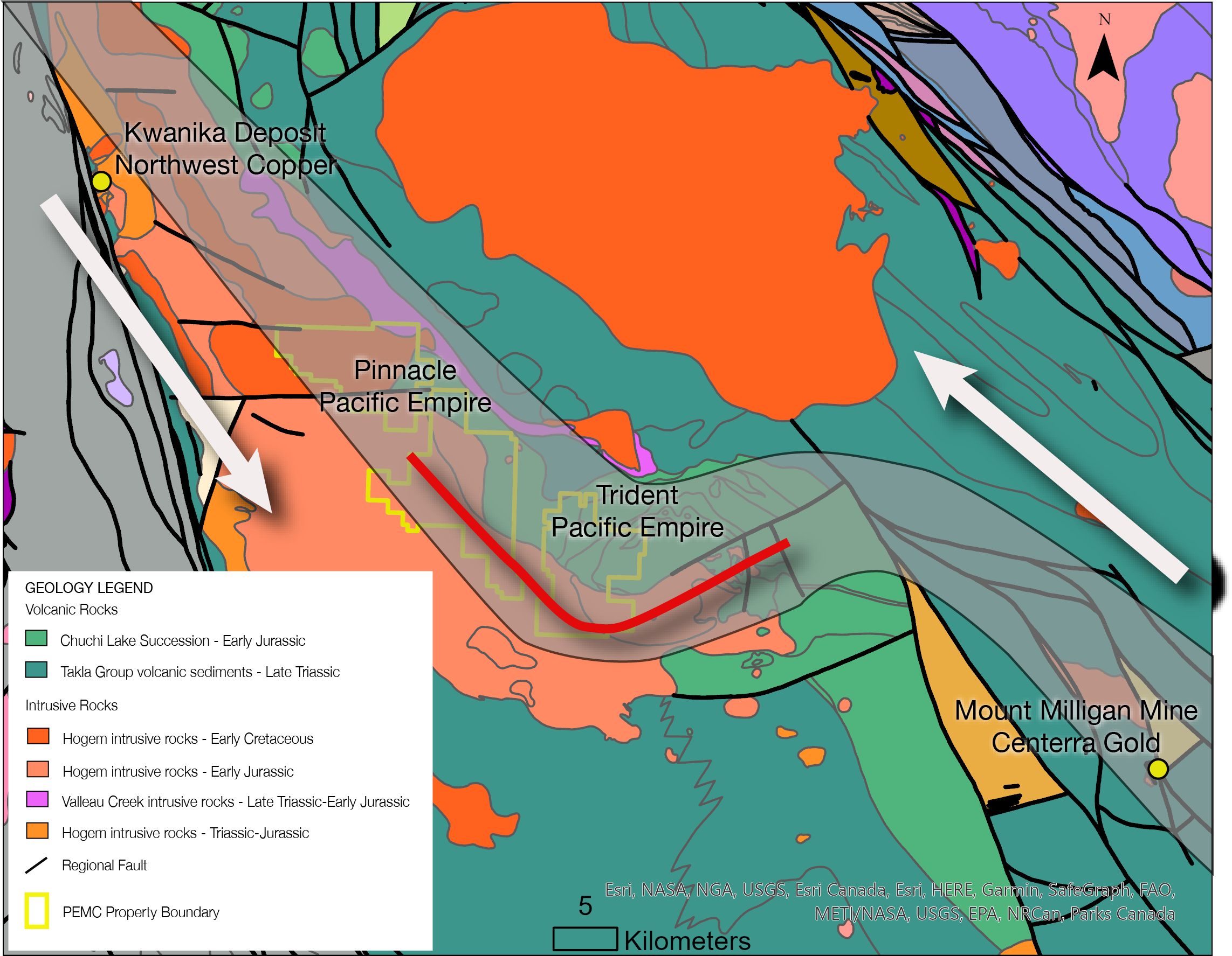
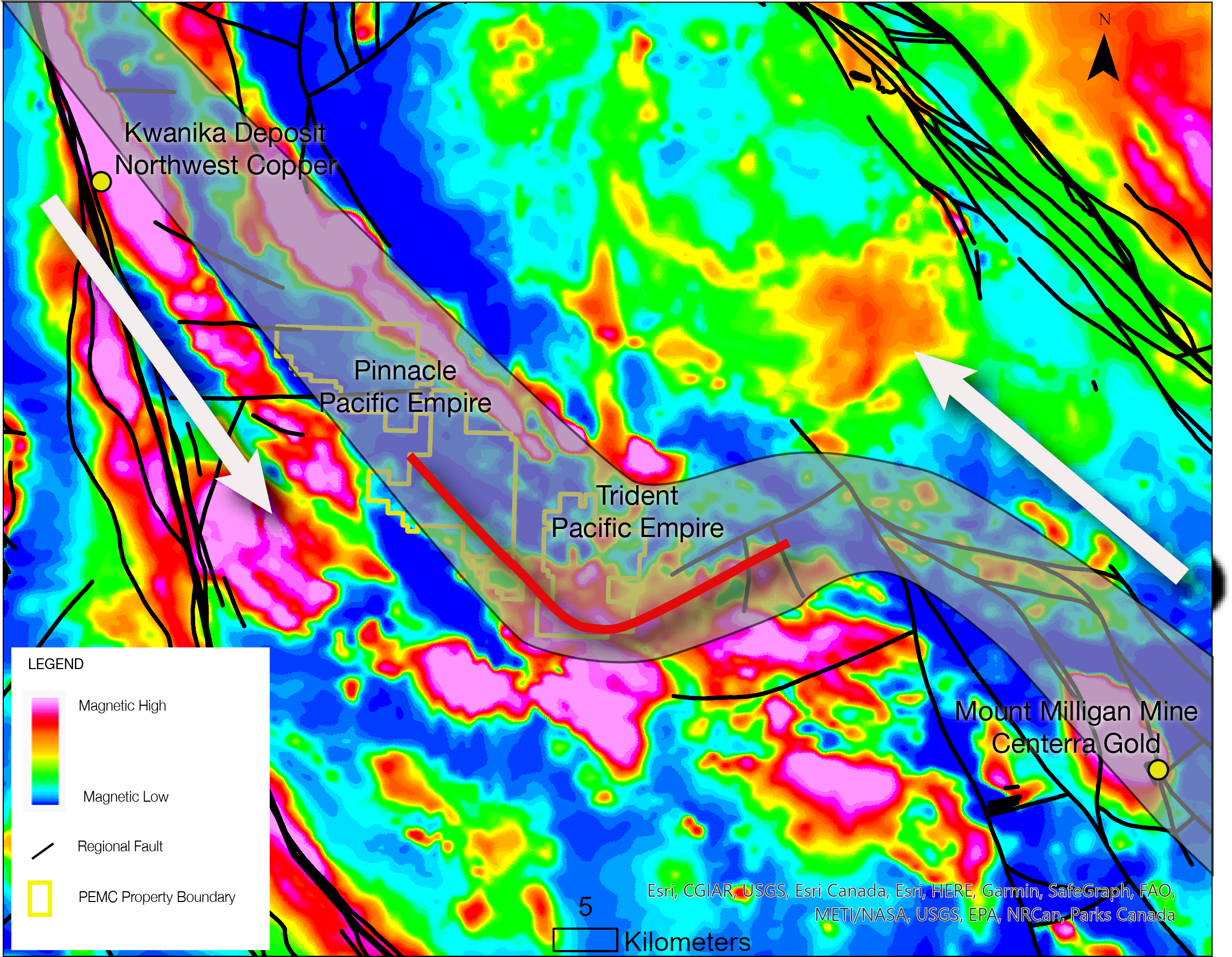
The Trident Property (6,618 ha) lies in the Quesnel Terrane of north-central British Columbia, about 50 km from both Kwanika and Mt. Milligan. It’s road-accessible and has seen multiple campaigns since its 1969 discovery, including Falconbridge (IP/mag, soils, mapping, DDH), Kookaburra, Solomon Resources, OZ Minerals (2014–15 IP and drilling), and PEMC.
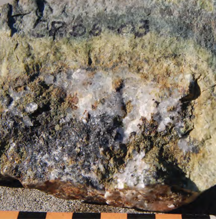
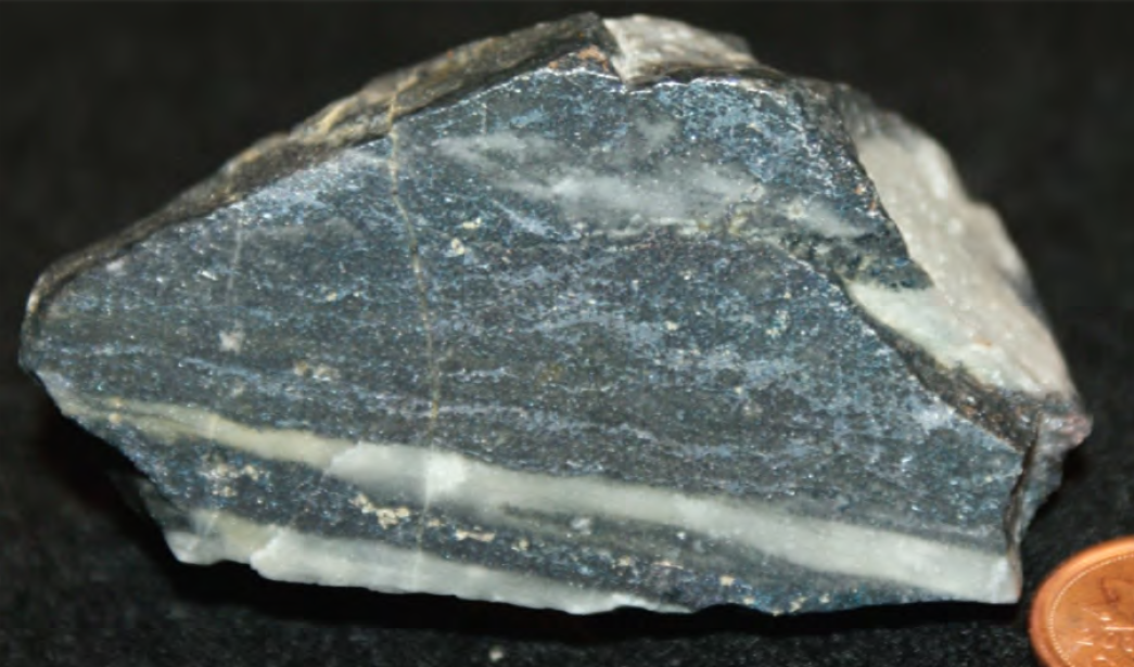
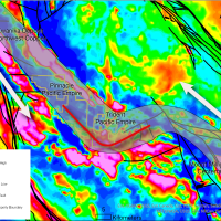
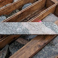
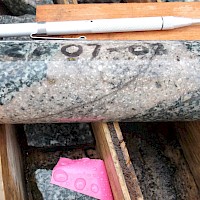
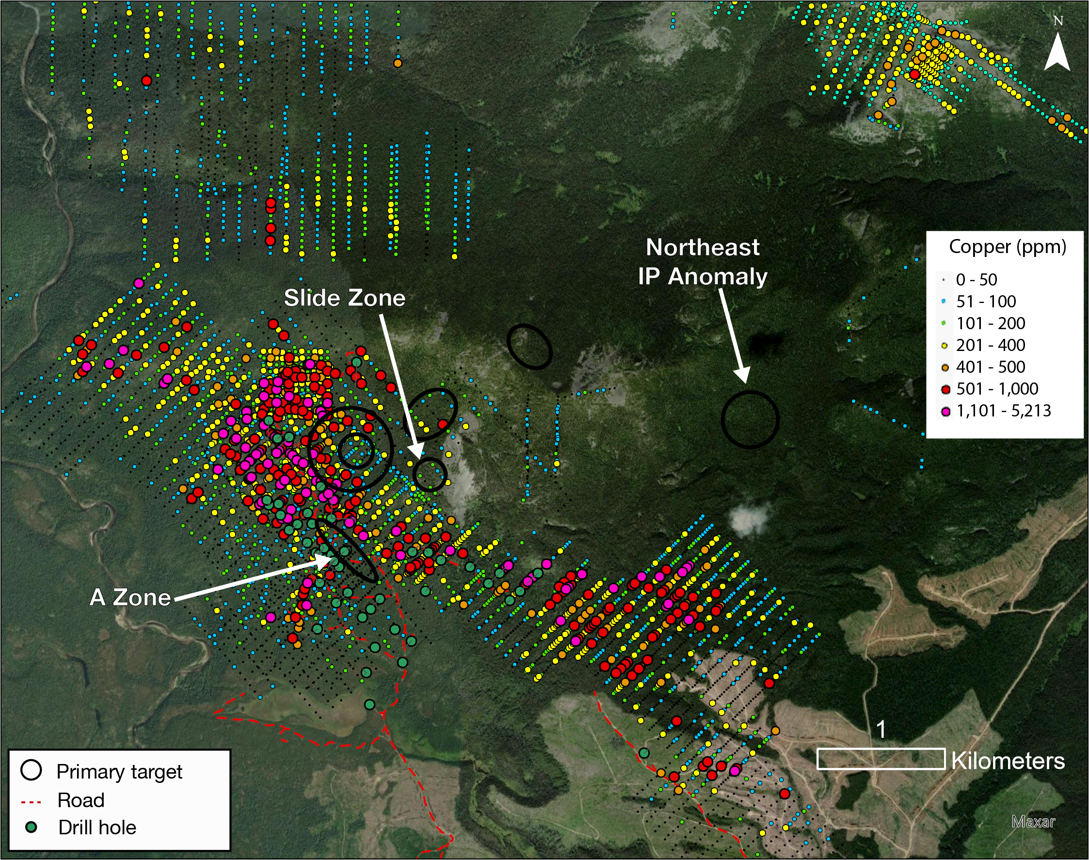
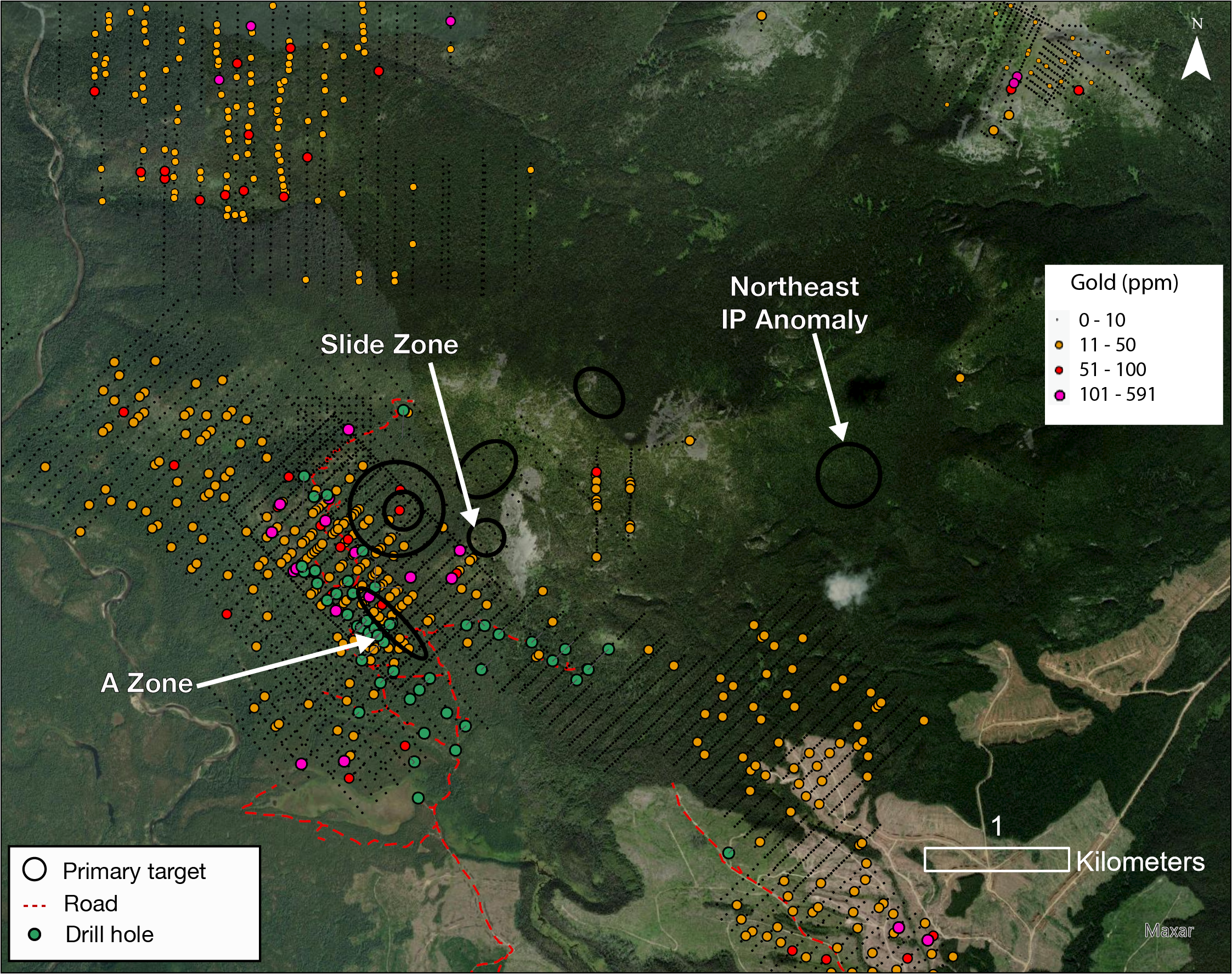
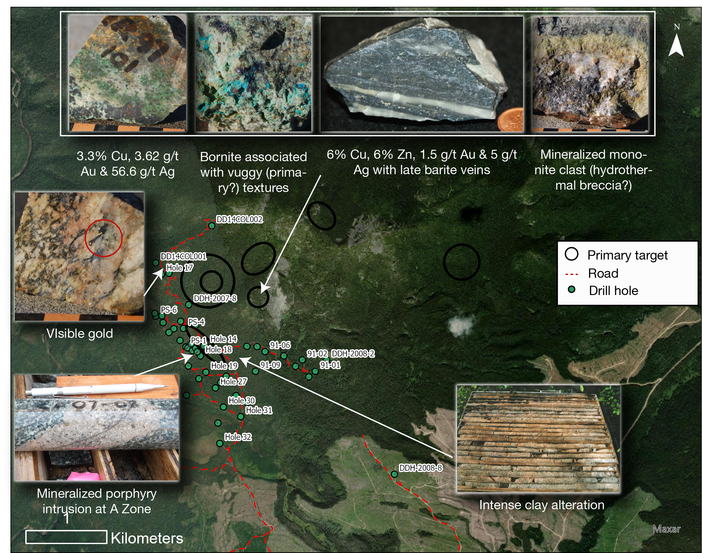
PEMC’s review of historical core identified hornblende–feldspar monzonite porphyry dikes at the A Zone, with sheeted quartz-sulfide veins and disseminated chalcopyrite-bornite—the highest grades occur within and adjacent to these dikes. Follow-up work indicates the mineralized system likely trends north of the A Zone, across a creek that limited earlier drilling, and coincides with chargeability features on the 2014 grid. The current program is designed to test this gold-enriched porphyry corridor and refine vectors to the centre of the system.
Why Trident
Between two district anchors: Kwanika (NorthWest Copper Corp.) & Mt. Milligan (Centerra Gold)
Gold-enriched copper porphyry
Road-accessible with compact work footprint
Clear geological/geochemical/geophysical/structural targets north of past drilling
Ownership & Terms
100% PEMC (2022)
2% NSR to vendors; 1% buyback for $500,000
Exploration in the district dates back to the 1950s (Lorraine). Trident’s discovery followed in 1969 when Colin Campbell identified what are now the A Zone and Campbell’s Trench while following up stream-sediment anomalies. Since then, campaigns by Falconbridge, Kookaburra, Solomon Resources, OZ Minerals and PEMC have progressively advanced the target toward a gold-enriched copper porphyry model.
1950s–1980s — District context
Regional work around Lorraine and later Mt. Milligan (discovered ~40 km east of Trident) established the area’s alkalic porphyry potential.
1969–1971 — Discovery & Falconbridge option
• Campbell discovers A Zone & Campbell’s Trench.
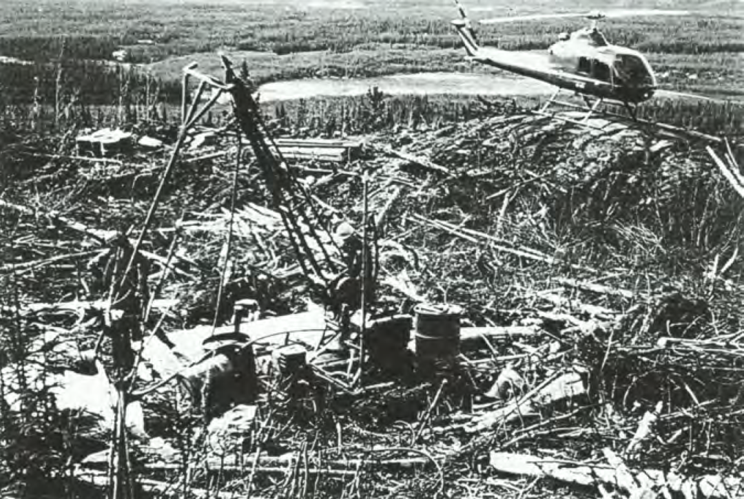
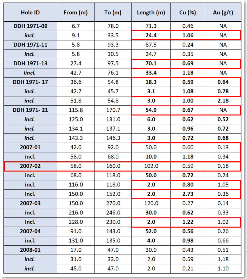
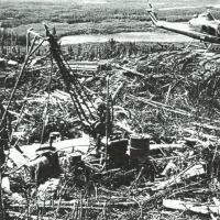
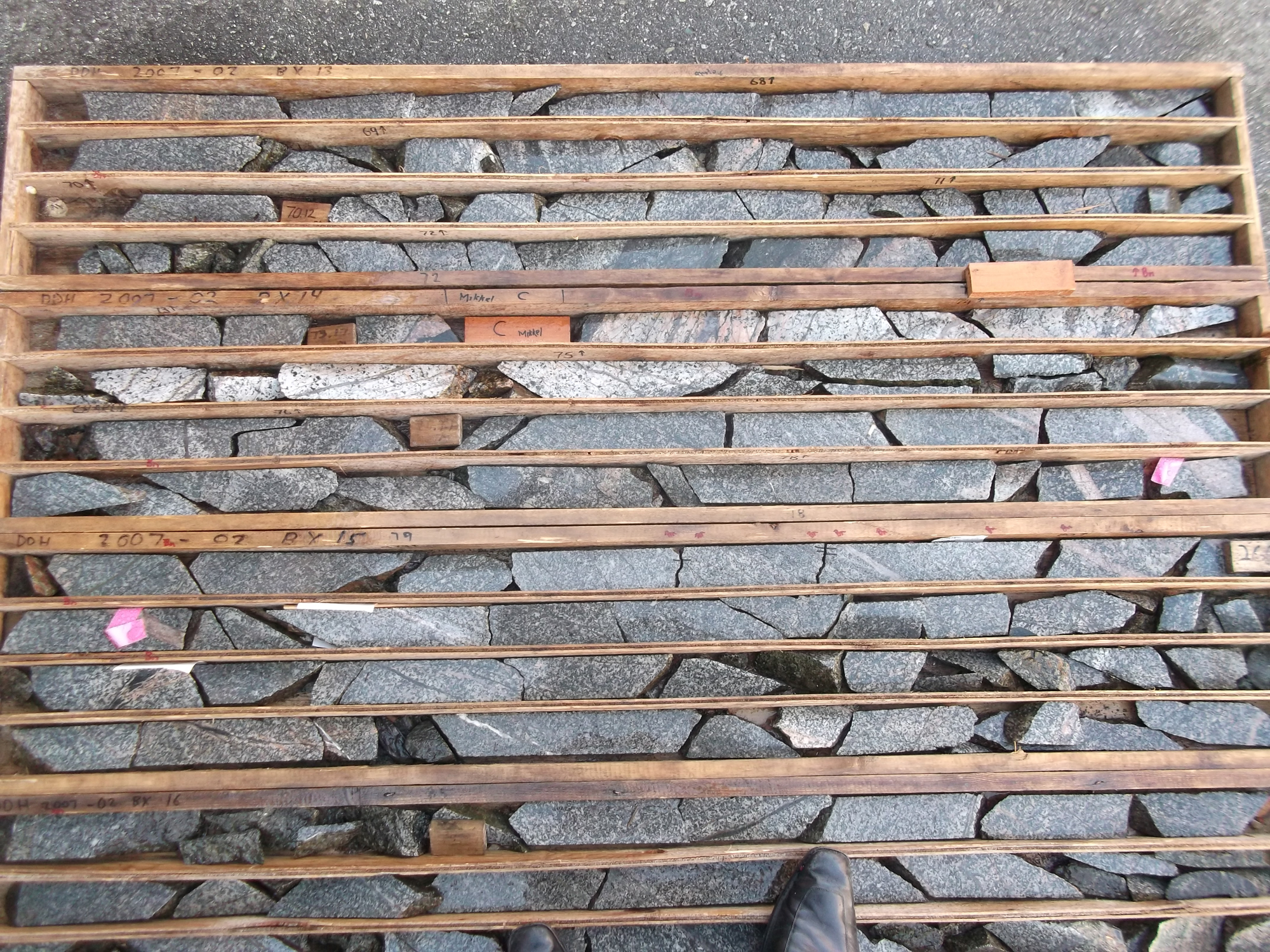
• Falconbridge establishes access from Chuchi Lake; completes soils, mapping, mag and IP; drills 13 packsack + 19 DDH.
• Work defines the A chargeability anomaly with coincident Cu-in-soil.
• Falconbridge outlined a historic, non-NI 43-101 estimate of 2–2.7 Mt @ ~0.6% Cu at A Zone (not current; see note below).
1988–1991 — Kookaburra Gold Corp.
• 1988: Grid from A Zone to Campbell’s Trench; 878 soils (Cu, Au, As, Pb, Zn, Ag, Fe).
• 1989: 490 m trenching (9 trenches); 116 rock samples; grid expanded; 22.4 line-km IP; 217 follow-up soils on IP anomalies.
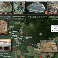
• Select Slide Zone grabs to 3.34% Cu, 0.106 oz/t Au (~3.6 g/t), 1.6 oz/t Ag (~55 g/t).
• 1991: 11 DDH / 1,524 m east of A Zone; holes cut chloritized syenite/monzonite (interpreted propylitic halo), suggesting better Cu grades with potassic alteration trending west.
2006–2008 — Solomon Resources
• Property expanded (Col–Magnet, 19,926 ha).
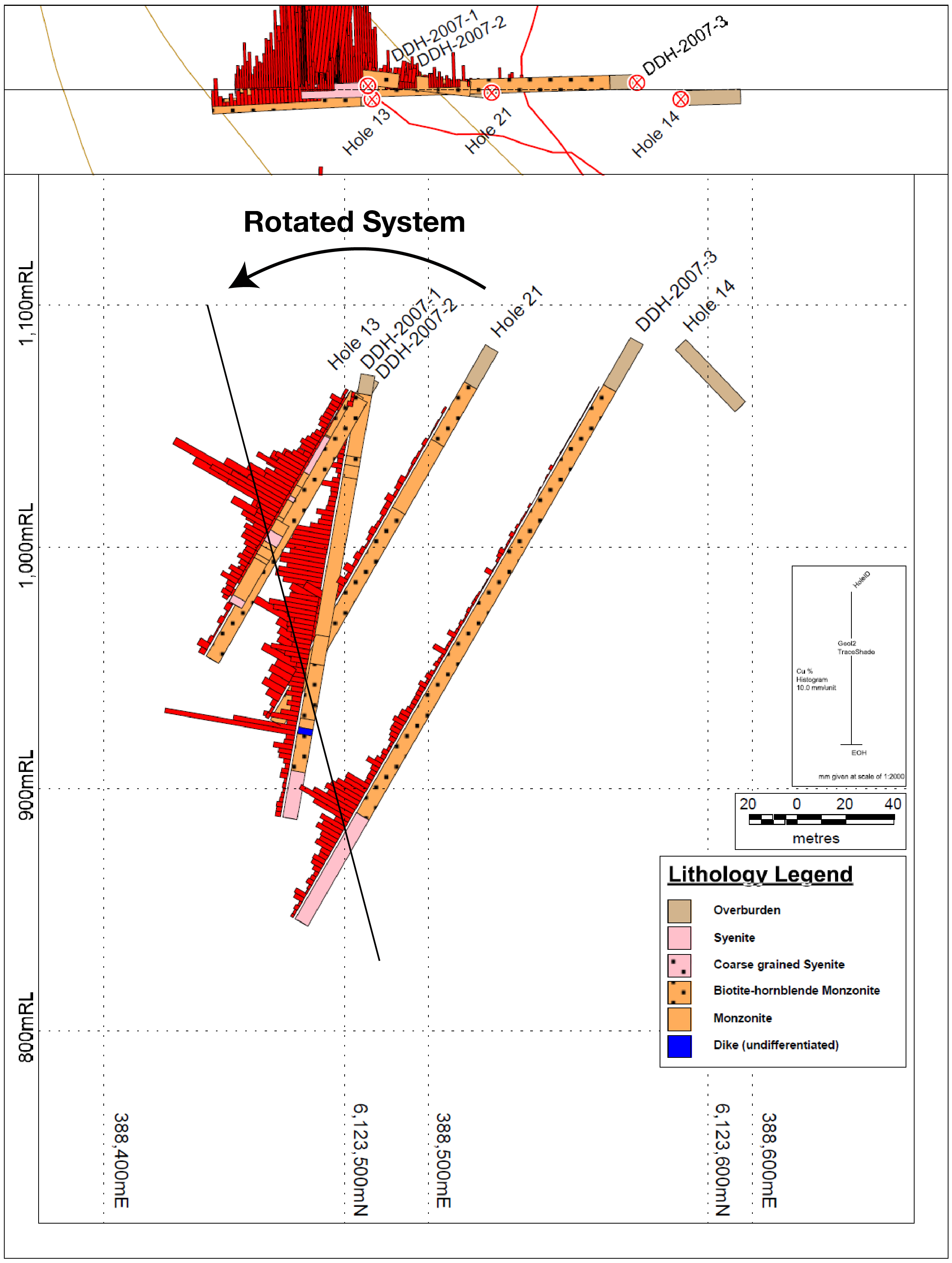
• 2007: DIGHEM airborne (1,458 line-km), mapping resistivity/magnetics; 2,564 m / 14 DDH at central Col and A Zone; reported ~0.6% Cu with 0.14–0.32 g/t Au over 25 m at A Zone; Slide Zone grabs returned multi-% Cu with Au/Ag.
• 2008: 8 DDH / 1,043 m on five targets; highlight 0.43% Cu & 0.51 g/t Au over 30 m (DDH-2008-1); mineralization linked to potassic-altered dikes in biotite-hornblende monzonite with bornite–chalcopyrite–pyrite.
2013–2015 — PEMC & OZ Minerals
• PEMC options the Col–Later (~24,000 ha); OZ funds work.
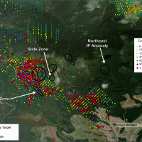
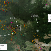
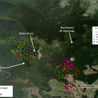
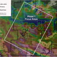
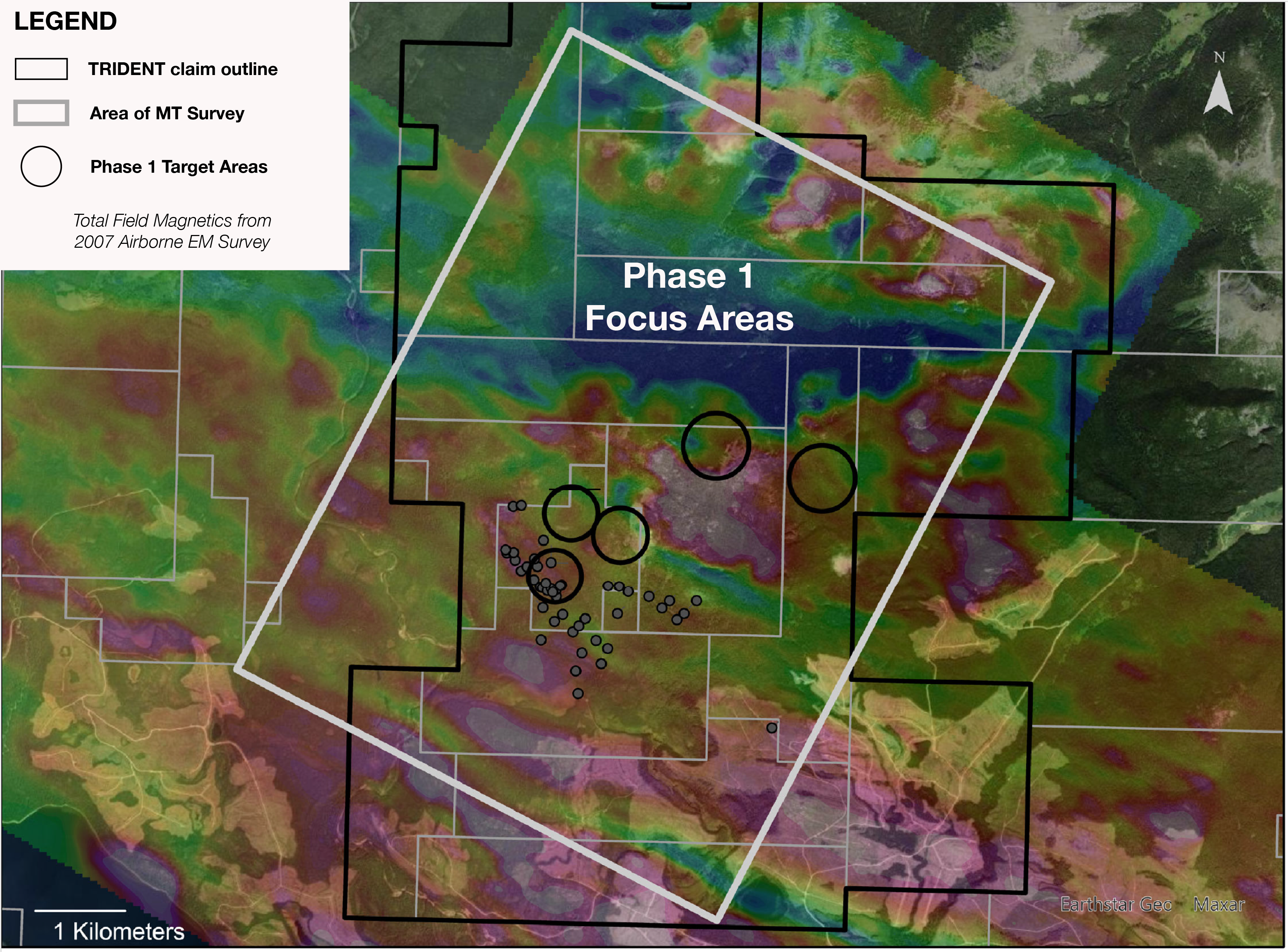
• 2014: 23.55 line-km IP over historical grids; 2 DDH / 847.5 m. Moderate, discrete chargeability at historical areas plus two large, high-amplitude anomalies in the NE of the grid (lightly tested). One hole west of Campbell’s Trench cut 12 m @ ~0.3% Cu (452–464 m) at end-of-hole.
• 2015: Additional IP and 6 DDH to the west. Option later dropped; ground returned.
2022 — Ownership consolidated
PEMC acquires 100% of Trident; vendors retain a 2% NSR (1% purchasable for $500,000).
2022–Present — Updated model & targeting
PEMC’s review of all available data supports the presence of a mineralized porphry in the immediate area (hornblende–feldspar monzonite dikes with sheeted quartz-sulfide veins, chalcopyrite-bornite halos). Geological and geophysical data outline a north-trending corridor—north of historical drilling across a small creek that constrained past work—interpreted to vector toward the porphyry centre.
>14,500 soils (digitized)
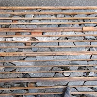
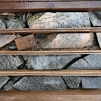
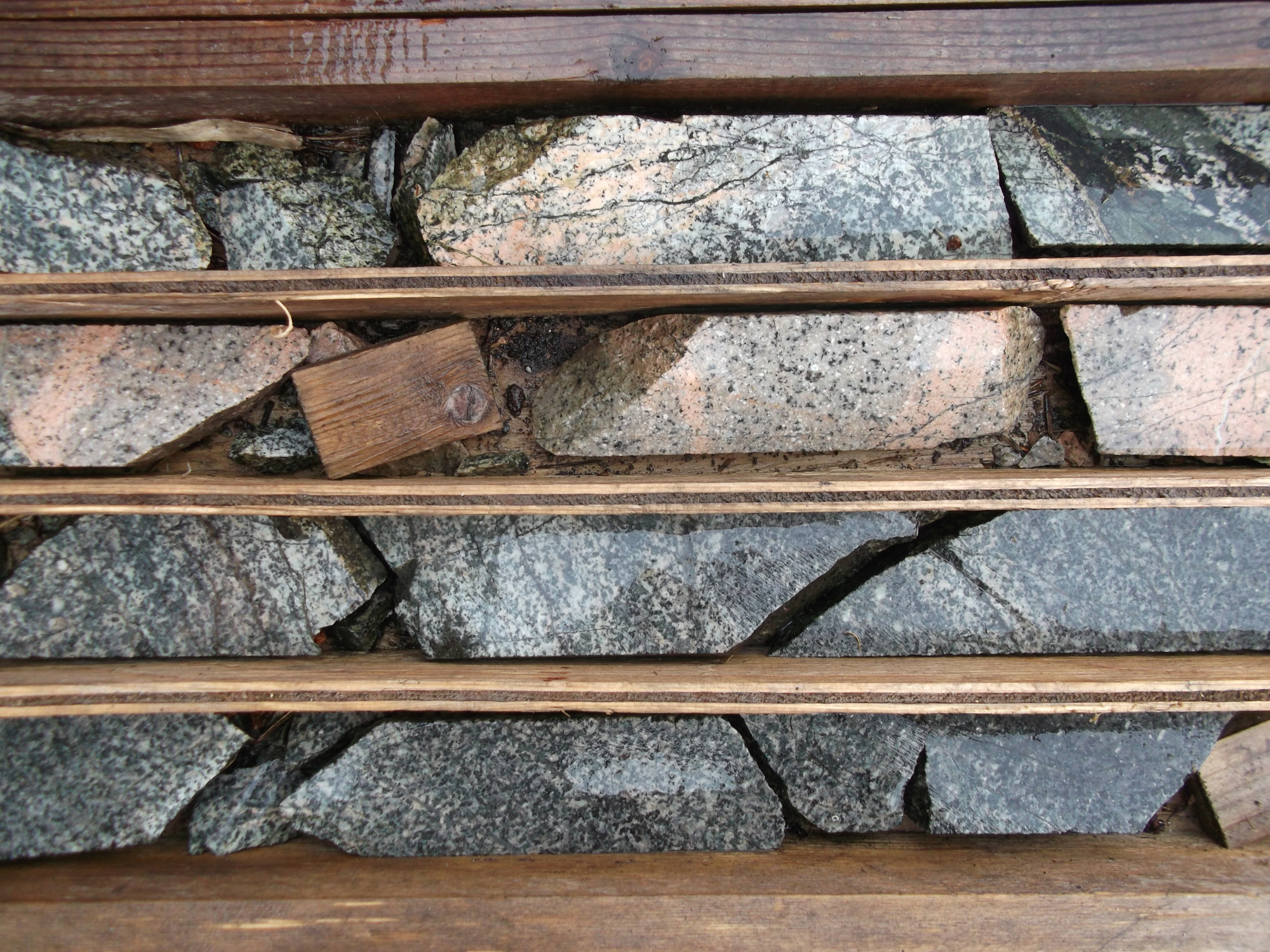
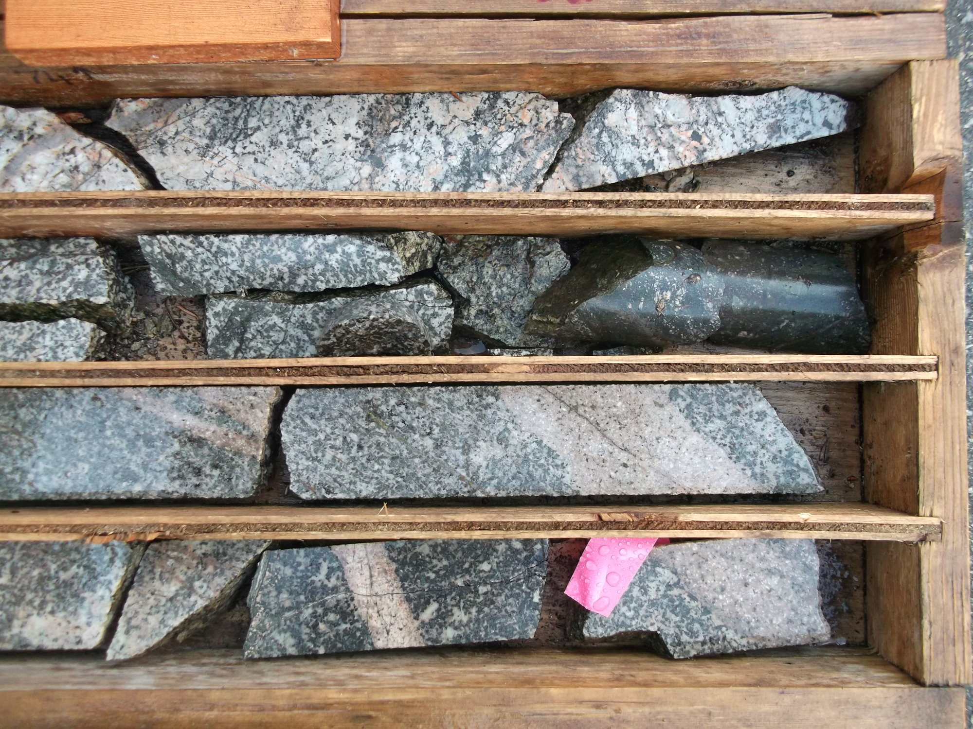
67 DDH totaling ~8,312 m (+ packsack drilling)
Multiple geophysics programs: IP, airborne EM/magnetics, and ground surveys
Road access and established pads/trails from historical work
Historical information caution: The Falconbridge tonnage/grade and other legacy results are historical and not current mineral resources or reserves under NI 43-101. PEMC has not done the work necessary to classify these estimates as current, and they should not be relied upon; they are referenced to provide geological context.
Highlights from Historical Drilling at Trident
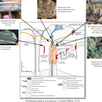
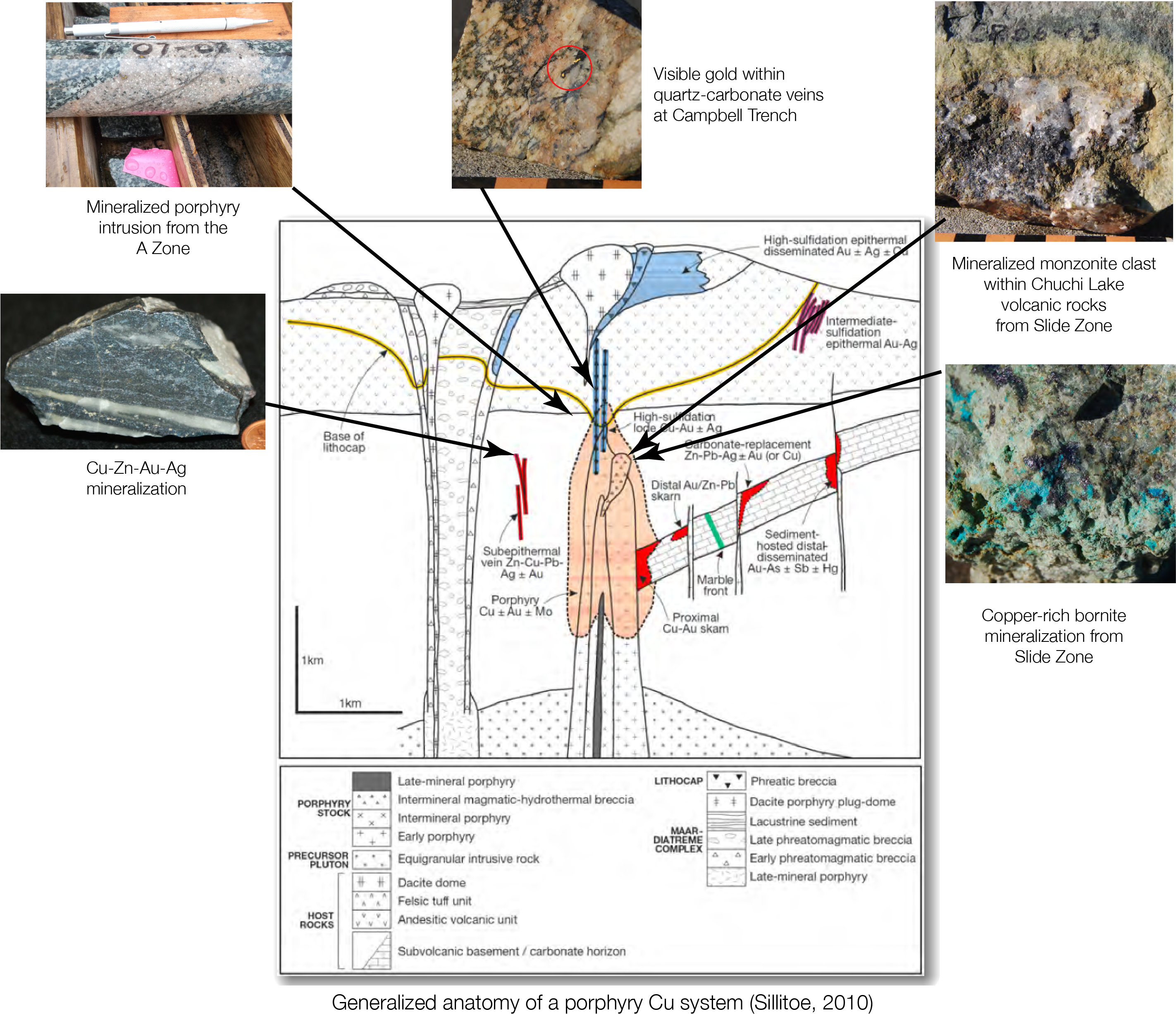
Setting. Trident sits in the Quesnel Terrane, a Late Triassic–Early Jurassic island-arc belt that hosts multiple alkalic porphyry Cu-Au deposits.
Host rocks. Early Jurassic shoshonitic volcanics of the Chuchi Lake Succession, intruded by phases of the Hogem Intrusive Suite (monzonite → syenite).
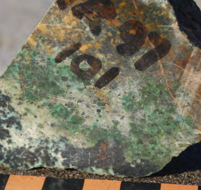
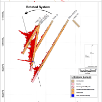
Mineralization. Gold-enriched copper occurs in quartz–chalcopyrite ± bornite veins/veinlets and disseminations with calc-potassic → potassic → propylitic alteration. The best grades are tied to late hornblende–feldspar monzonite porphyry dikes that cut earlier intrusions—interpreted as mineralized feeders.
Why it matters. Historical drilling includes broad copper-gold intervals (e.g., 102 m of 0.588% Cu & 0.244 g/t Au) and shorter, higher-grade hits adjacent to the dikes. Priority areas are slated for diamond drilling in 2025.
Objective. Test a gold-enriched copper porphyry system north of historical drilling (across the small creek) by drilling down the mineralized dike corridor and into coincident geophysical and geochemical anomalies.
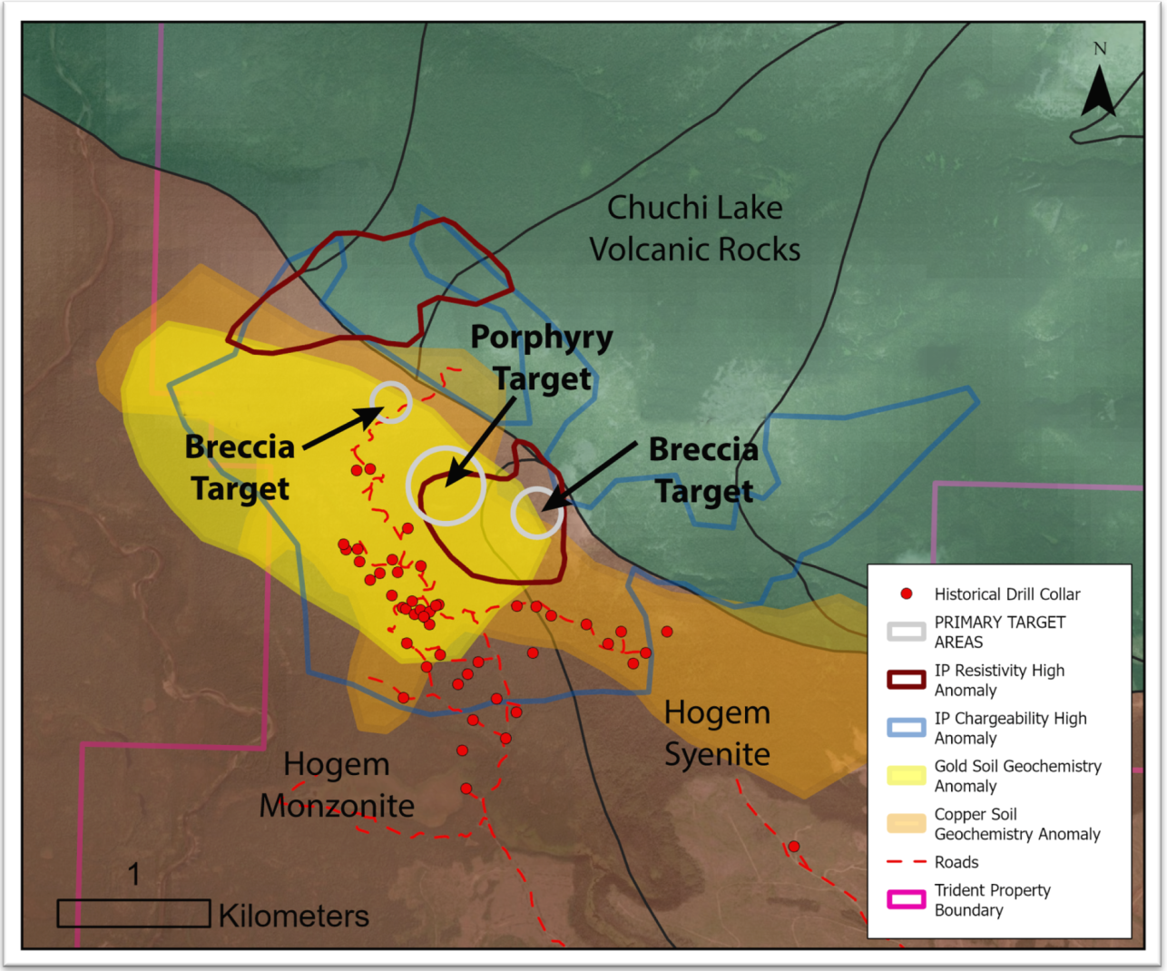
Where: Central corridor, immediately north of the A Zone.
Why here:
Cu–Au in soils (overlapping copper + gold anomalies)
IP chargeability highs coincident with a resistivity break
Structural focus along the monzonite–syenite contact and dike swarm
What we’re testing: A late hornblende–feldspar monzonite porphyry dike system that may vector toward the porphyry centre.
Planned approach: 2 oriented core holes, south → north, designed to cut down-dike through the chargeability high and into the resistive core.
Where: West side of the corridor.
Why here:
Chargeability high flanking the porphyry corridor
Strong Cu-in-soil with local Au support
Proximity to mapped brecciation and intrusive contacts
What we’re testing: A hydrothermal breccia related to the porphyry system (potential fluid pathway and higher-grade shoots).
Planned approach: 1 oriented hole from the south margin to cross the breccia body and underlying intrusive.
Where: East side of the corridor.
Why here:
Chargeability envelope with Au-in-soil overlap
Structural intersection on the east limb of the corridor
What we’re testing: A second breccia vent/pipe or dike-proximal zone that could host bornite–chalcopyrite vein networks.
Planned approach: 1–2 oriented holes to transect the anomaly and tie back to the central porphyry trend.
Program at a glance (example plan)
~5 holes / ~2,500 m total (adjustable on results)
Orientation: S → N, az. 355–005°, dip ~-55° (optimize for down-dike cuts)
Depths: Porphyry holes 500–650 m; breccia tests 300–450 m
Core: Oriented for vein/dike attitude and vectoring
Success criteria (decision points):
Increasing vein density and K-feldspar/biotite (potassic) alteration down-hole
Chalcopyrite ± bornite with magnetite ± quartz stockwork
Continuous Cu-Au intervals suitable for step-outs (broad moderate grade or shorter high grade)
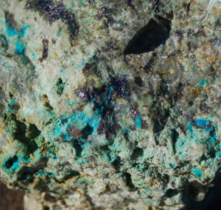
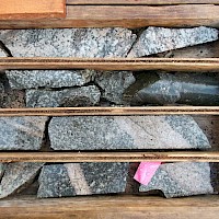
One of the more intriguing examples of mineralization on the property can be found at the Slide Zone and the East Breccia Target. Located approximately 1 km to the northeast of the A Zone, the Slide Zone occurs within Chuchi Lake Succession volcanic rocks and is characterized by a wide variety of mineralizatoin styles.
Select grab samples from the area in 2007 returned the following values:
17,700 ppm Cu, 948 ppb Au, 16.4 ppm Ag; Sample 96568
5,535 ppm Cu, 429 ppb Au; Sample 96571;
3,739 ppm Cu, 302 ppb Au; Sample 96570
In this area, the occurrence of mineralized monzonite clasts within volcanic rocks suggests the source may be a hydrothermal breccia in the immediate area. This is a priority target for follow up in 2024.